Mode
Year
2016 Overlay


How to Get around
Mode Menu
Switching modes using the Mode menu:
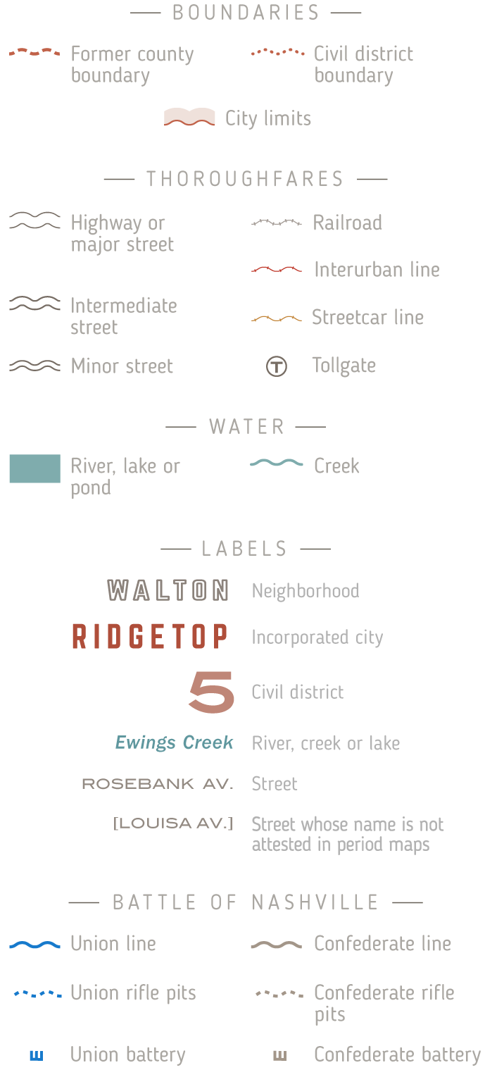
Just Maps mode does what it says, displaying maps only. The maps depict Nashville and Davidson County in 1871, 1903, 1929 and 1952, with the option to overlay a relatively modern (2016) map for comparison.
Landmarks mode displays info about and photos of historical buildings and other structures in existence at the time of the selected map.
Streets mode covers the origin of street names where known, former names where applicable, and some street-related historical and geographic trivia.
Battle of Nashville Mode: A static map (for now) of the fortifications, earthworks and troop positions on December 15th, 1864, along with an optional modern-map overlay.
Year Menu
The year menu controls which year is displayed in Just Maps and Landmarks modes. In Streets mode the year is set to 2016 and in Battle of Nashville mode the year is set to 1864.
2016 Overlay
The 2016 overlay option allows the user in Just Maps and Battle of Nashville modes to compare historical maps with a modern map overlay.
The Concept
Having an interest in history, questions would occur to me as I drove around my city. What used to occupy that vacant lot? Why does this street make a sudden jog? What did this neighborhood look like 100 years ago?
Atlases, and especially historical atlases, normally take the world or a country as their scope, but every place no matter the size has its own story. What kind of information would a historical atlas of a city contain? What would a map-based, infrastructure-focused approach to local history look like?
Support
If you’ve enjoyed this site or found it useful, you may want to make a contribution to defray the ongoing costs of development and hosting. Any amount will be appreciated. PayPal can be used for one-time donations and Patreon for recurring donations.


The Atlas Store
Nashville-themed t-shirts, maps, tote bags and caps, some historical and some not: https://mero-district.com.
About the Creator
I’m a lifelong fan of maps and history, and since the dawn of the internet era, online interactives. Since 1989 I’ve lived with my wife Sheryl in East Nashville and currently hold a day job as a UX designer.

My parents and me on a train trip during that brief interval between JFK and the Beatles. I’m holding a copy of Rand McNally’s 1962 “Book of the United States”, probably a recent Christmas present
About the Developer
Amrit Karmacharya is a survey officer with the Government of Nepal. He has a background in crowdsourcing, Arcgis products, OSM, PHP, and data visualization, and a masters in geoinformatics from Jaume I University.